
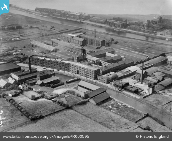
EPR000595 ENGLAND (1935). The Highfield Tannery and environs, Runcorn, 1935
© Copyright OpenStreetMap contributors and licensed by the OpenStreetMap Foundation. 2026. Cartography is licensed as CC BY-SA.
Nearby Images (7)
EPR000595

EPR000596

EPR000513

EPR000512A

EPR000597

EPR000594

EPR000598

Details
| Title | [EPR000595] The Highfield Tannery and environs, Runcorn, 1935 |
| Reference | EPR000595 |
| Date | 10-May-1935 |
| Link | |
| Place name | RUNCORN |
| Parish | |
| District | |
| Country | ENGLAND |
| Easting / Northing | 352678, 382980 |
| Longitude / Latitude | -2.7108286701952, 53.341332303305 |
| National Grid Reference | SJ527830 |
Pins

Bottom Yard |
Wednesday 26th of December 2018 11:25:41 PM | |
|
Bottom Yard |
Wednesday 26th of December 2018 11:15:38 PM |