
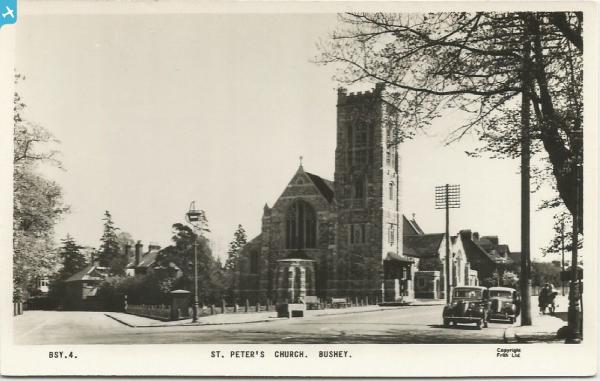
EPR000522 ENGLAND (1935). St Peter's Church, Bushey Heath, 1935

© Copyright OpenStreetMap contributors and licensed by the OpenStreetMap Foundation. 2025. Cartography is licensed as CC BY-SA.
Nearby Images (2)
EPR000522

EAW026506

Details
| Title | [EPR000522] St Peter's Church, Bushey Heath, 1935 |
| Reference | EPR000522 |
| Date | 27-March-1935 |
| Link | |
| Place name | BUSHEY HEATH |
| Parish | |
| District | |
| Country | ENGLAND |
| Easting / Northing | 514537, 194432 |
| Longitude / Latitude | -0.34475170053781, 51.636550364606 |
| National Grid Reference | TQ145944 |
Pins
 |
 ordinarybloke |
Wednesday 11th of April 2018 08:13:21 AM |