
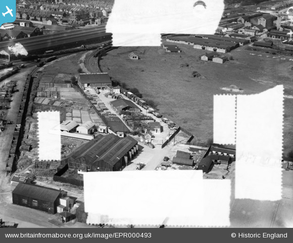
EPR000493 ENGLAND (1935). J. Alfred Pratt and Co Ltd Depot, Watford, 1935. This image was marked by Aero Pictorial Ltd for photo editing.
© Copyright OpenStreetMap contributors and licensed by the OpenStreetMap Foundation. 2026. Cartography is licensed as CC BY-SA.
Nearby Images (20)
EPR000493

EPR000491

EPR000490

EPR000492

EAW048386

EAW048389

EAW048382

EAW048390

EAW048385

EAW048387

EAW048381

EAW048383

EAW048384

EPW060249

EAW048388

EAW038560

EAW038556
 premises and Watford Junction Railway Station, Watford, 1951. This image has been produced from a copy-negative.")
EPW006198
, Watford, 1921")
EPW037384

EPW060248

Details
| Title | [EPR000493] J. Alfred Pratt and Co Ltd Depot, Watford, 1935. This image was marked by Aero Pictorial Ltd for photo editing. |
| Reference | EPR000493 |
| Date | 27-March-1935 |
| Link | |
| Place name | WATFORD |
| Parish | |
| District | |
| Country | ENGLAND |
| Easting / Northing | 511169, 197514 |
| Longitude / Latitude | -0.39242401174154, 51.664929513389 |
| National Grid Reference | TQ112975 |
Pins
Be the first to add a comment to this image!