
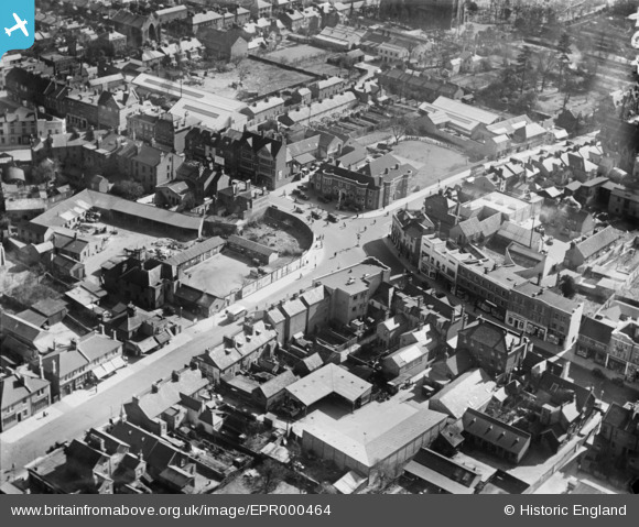
EPR000464 ENGLAND (1935). The junction of the Hight Street, William Street and Windsor Road, Slough, 1935
© Copyright OpenStreetMap contributors and licensed by the OpenStreetMap Foundation. 2026. Cartography is licensed as CC BY-SA.
Nearby Images (13)
EPR000464

EPW056578

EAW030167

EPW012475

EPW061200

EPW061091

EPW056580

EPW061092

EPW061199

EPW012477

EAW029472

EPW061201

EPW056577

Details
| Title | [EPR000464] The junction of the Hight Street, William Street and Windsor Road, Slough, 1935 |
| Reference | EPR000464 |
| Date | 21-March-1935 |
| Link | |
| Place name | SLOUGH |
| Parish | |
| District | |
| Country | ENGLAND |
| Easting / Northing | 497582, 179893 |
| Longitude / Latitude | -0.59373230412175, 51.509047281041 |
| National Grid Reference | SU976799 |
Pins

dave43 |
Monday 1st of July 2019 08:58:24 PM | |

fern |
Monday 11th of February 2019 05:08:43 PM | |
|
fern |
Monday 11th of February 2019 05:06:47 PM | |
|
dave43 |
Friday 2nd of January 2015 10:09:44 PM |