
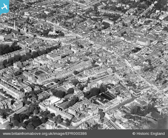
EPR000386 ENGLAND (1934). The town centre, Cheltenham, 1934
© Copyright OpenStreetMap contributors and licensed by the OpenStreetMap Foundation. 2026. Cartography is licensed as CC BY-SA.
Nearby Images (5)
EPR000386

EPW000196

EPW024140

EPW000177

EPW000198

Details
| Title | [EPR000386] The town centre, Cheltenham, 1934 |
| Reference | EPR000386 |
| Date | 28-September-1934 |
| Link | |
| Place name | CHELTENHAM |
| Parish | |
| District | |
| Country | ENGLAND |
| Easting / Northing | 394963, 222295 |
| Longitude / Latitude | -2.073213574539, 51.898740766334 |
| National Grid Reference | SO950223 |
Pins

drjameslambert |
Friday 11th of August 2023 03:58:56 PM | |
|
Caroline |
Tuesday 24th of November 2020 08:30:25 AM | |
|
Paul D Scott |
Tuesday 28th of July 2015 03:40:16 PM | |
|
Toby Clempson |
Friday 31st of October 2014 10:43:56 AM | |
|
Toby Clempson |
Friday 31st of October 2014 10:41:50 AM |