
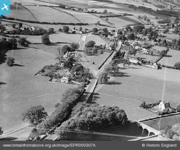
EPR000307A ENGLAND (1934). The village, Heversham, 1934. This image was marked by Aero Pictorial Ltd for photo editing.
© Copyright OpenStreetMap contributors and licensed by the OpenStreetMap Foundation. 2025. Cartography is licensed as CC BY-SA.
Nearby Images (4)
EPR000307A

EPR000300

EPR000307

EPR000302

Details
| Title | [EPR000307A] The village, Heversham, 1934. This image was marked by Aero Pictorial Ltd for photo editing. |
| Reference | EPR000307A |
| Date | 30-August-1934 |
| Link | |
| Place name | HEVERSHAM |
| Parish | HEVERSHAM |
| District | |
| Country | ENGLAND |
| Easting / Northing | 349680, 483000 |
| Longitude / Latitude | -2.7721946516578, 54.240057856847 |
| National Grid Reference | SD497830 |
Pins
Be the first to add a comment to this image!