
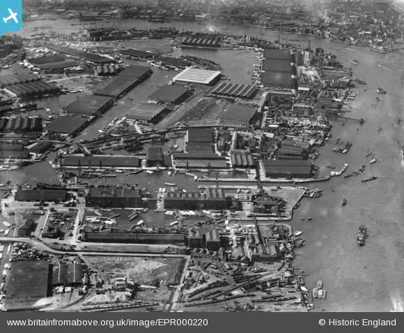
EPR000220 ENGLAND (1934). Surrey Commercial Docks, Rotherhithe, 1934
© Copyright OpenStreetMap contributors and licensed by the OpenStreetMap Foundation. 2026. Cartography is licensed as CC BY-SA.
Nearby Images (12)
EPR000220

EPW044143

EAW045684

EAW045681

EAW045682

EAW045686

EAW045687

EPW044147

EAW045688

EAW118732

EAW045683

EAW045685

Details
| Title | [EPR000220] Surrey Commercial Docks, Rotherhithe, 1934 |
| Reference | EPR000220 |
| Date | 17-July-1934 |
| Link | |
| Place name | ROTHERHITHE |
| Parish | |
| District | |
| Country | ENGLAND |
| Easting / Northing | 536450, 179284 |
| Longitude / Latitude | -0.034139974719467, 51.495524542947 |
| National Grid Reference | TQ365793 |
Pins

@JohnSouthsea |
Tuesday 12th of April 2022 05:58:59 PM |