
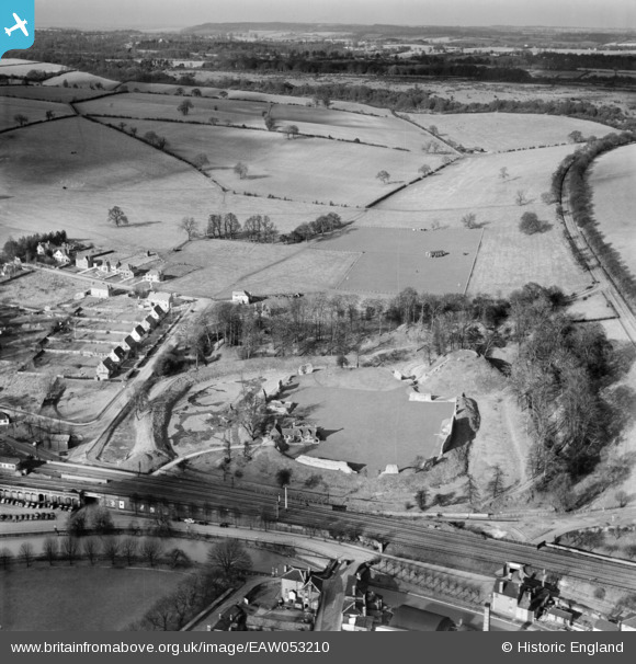
EAW053210 ENGLAND (1954). The remains of Berkhamsted Castle, Berkhamsted, from the south, 1954
© Copyright OpenStreetMap contributors and licensed by the OpenStreetMap Foundation. 2026. Cartography is licensed as CC BY-SA.
Nearby Images (24)
EAW053210

EAW053209

EAW048763

EAW014226

EAW048762

EAW004823

EAW049279

EAW014222

EAW049277

EAW014225

EAW004825

EAW004824

EAW014224

EAW048761

EAW014227

EAW053212A

EAW049276

EAW004826

EAW014228

EAW041753

EAW048760

EAW049278

EAW014223

EAW053211

Details
| Title | [EAW053210] The remains of Berkhamsted Castle, Berkhamsted, from the south, 1954 |
| Reference | EAW053210 |
| Date | 10-March-1954 |
| Link | |
| Place name | BERKHAMSTED |
| Parish | BERKHAMSTED |
| District | |
| Country | ENGLAND |
| Easting / Northing | 499486, 208138 |
| Longitude / Latitude | -0.55827290539093, 51.762622629607 |
| National Grid Reference | SP995081 |
Pins
Be the first to add a comment to this image!