
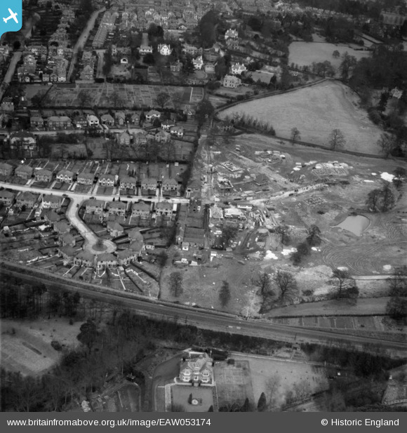
EAW053174 ENGLAND (1954). Banner Farm Estate in the early stages of construction, Royal Tunbridge Wells, 1954
© Copyright OpenStreetMap contributors and licensed by the OpenStreetMap Foundation. 2026. Cartography is licensed as CC BY-SA.
Nearby Images (21)
EAW053174

EAW053168

EAW053172

EAW053173

EAW053176

EAW053175

EPW032971

EPW032966

EAW053169

EAW053167

EPW032960

EPW032964

EAW053170

EPW032959

EAW053171

EPW032963

EPW032968

EPW032962

EPW032961

EPW032965

EPW032967

Details
| Title | [EAW053174] Banner Farm Estate in the early stages of construction, Royal Tunbridge Wells, 1954 |
| Reference | EAW053174 |
| Date | 22-February-1954 |
| Link | |
| Place name | ROYAL TUNBRIDGE WELLS |
| Parish | |
| District | |
| Country | ENGLAND |
| Easting / Northing | 558876, 138644 |
| Longitude / Latitude | 0.27059533423614, 51.124488696838 |
| National Grid Reference | TQ589386 |
Pins
Be the first to add a comment to this image!