
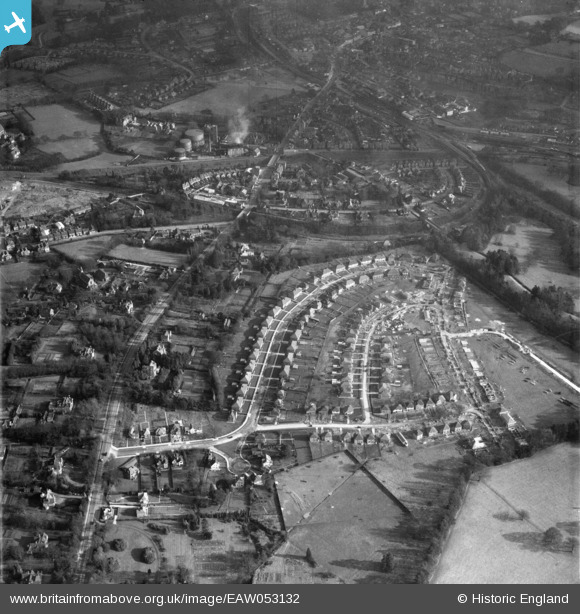
EAW053132 ENGLAND (1954). Housing under construction around Linden Avenue, London Road and environs, East Grinstead, 1954
© Copyright OpenStreetMap contributors and licensed by the OpenStreetMap Foundation. 2026. Cartography is licensed as CC BY-SA.
Nearby Images (7)
EAW053132

EAW053136

EAW053132A

EAW053129

EAW053131

EAW053130

EAW053137

Details
| Title | [EAW053132] Housing under construction around Linden Avenue, London Road and environs, East Grinstead, 1954 |
| Reference | EAW053132 |
| Date | 20-February-1954 |
| Link | |
| Place name | EAST GRINSTEAD |
| Parish | EAST GRINSTEAD |
| District | |
| Country | ENGLAND |
| Easting / Northing | 538525, 138714 |
| Longitude / Latitude | -0.020026793555504, 51.130401908941 |
| National Grid Reference | TQ385387 |
Pins

David Posnett |
Thursday 27th of December 2018 10:49:01 AM | |
|
David Posnett |
Thursday 27th of December 2018 10:48:28 AM |