
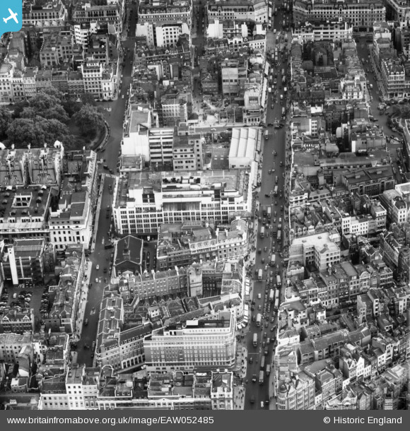
EAW052485 ENGLAND (1953). Oxford Street west of Oxford Circus, Westminster, 1953
© Copyright OpenStreetMap contributors and licensed by the OpenStreetMap Foundation. 2026. Cartography is licensed as CC BY-SA.
Nearby Images (27)
EAW052485

EAW050865

EAW050866

EAW050843

EAW050859

EAW030115

EPW006304

EAW052486

EPW060758

EAW050840

EAW000559

EAW050856

EPW021443

EAW050836

EPW021404

EPW021934

EAW050838

EAW052487

EPW047237

EAW052488

EAW050839

EPW045398

EAW000563

EAW000560

EPW053003

EPW059412

EAW041946

Details
| Title | [EAW052485] Oxford Street west of Oxford Circus, Westminster, 1953 |
| Reference | EAW052485 |
| Date | 30-September-1953 |
| Link | |
| Place name | WESTMINSTER |
| Parish | |
| District | |
| Country | ENGLAND |
| Easting / Northing | 528699, 181211 |
| Longitude / Latitude | -0.14504189905914, 51.514662048123 |
| National Grid Reference | TQ287812 |
Pins
Be the first to add a comment to this image!