
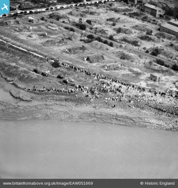
EAW051669 ENGLAND (1953). Brough, Crowds gathered at Brough Haven for the crossing of the River Humber by Lord Noel-Buxton, 1953
© Copyright OpenStreetMap contributors and licensed by the OpenStreetMap Foundation. 2026. Cartography is licensed as CC BY-SA.
Nearby Images (3)
EAW051669

EAW051668

EAW051666

Details
| Title | [EAW051669] Brough, Crowds gathered at Brough Haven for the crossing of the River Humber by Lord Noel-Buxton, 1953 |
| Reference | EAW051669 |
| Date | 27-August-1953 |
| Link | |
| Place name | BROUGH |
| Parish | ELLOUGHTON-CUM-BROUGH |
| District | |
| Country | ENGLAND |
| Easting / Northing | 493653, 426290 |
| Longitude / Latitude | -0.58044311215821, 53.724372067519 |
| National Grid Reference | SE937263 |
Pins

Matt Aldred edob.mattaldred.com |
Thursday 11th of January 2024 03:09:17 PM | |

Chris Kolonko |
Wednesday 29th of January 2020 02:21:59 PM | |
|
Chris Kolonko |
Wednesday 29th of January 2020 02:21:43 PM | |
|
John Wass |
Wednesday 29th of October 2014 02:40:39 PM |
User Comment Contributions
Please note that the correct name for this water way is "Humber Estuary". Humber in old English means river! |
John Wass |
Wednesday 29th of October 2014 02:42:50 PM |