
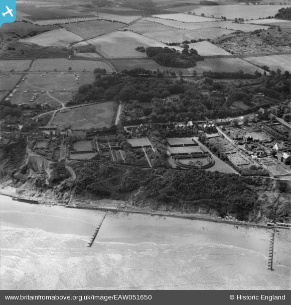
EAW051650 ENGLAND (1953). The High Street and the seafront, Overstrand, 1953
© Copyright OpenStreetMap contributors and licensed by the OpenStreetMap Foundation. 2026. Cartography is licensed as CC BY-SA.
Nearby Images (4)
EAW051650

EPW021222

EAW051651

EAW051652

Details
| Title | [EAW051650] The High Street and the seafront, Overstrand, 1953 |
| Reference | EAW051650 |
| Date | 26-August-1953 |
| Link | |
| Place name | OVERSTRAND |
| Parish | OVERSTRAND |
| District | |
| Country | ENGLAND |
| Easting / Northing | 625021, 340786 |
| Longitude / Latitude | 1.3474225807014, 52.916958323041 |
| National Grid Reference | TG250408 |
Pins

pf329 |
Saturday 11th of July 2015 06:23:37 PM |