
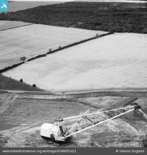
EAW051411 ENGLAND (1953). Walking dragline near Bangrave Wood, Weldon, 1953
© Copyright OpenStreetMap contributors and licensed by the OpenStreetMap Foundation. 2025. Cartography is licensed as CC BY-SA.
Nearby Images (6)
EAW051411

EAW051408

EAW051409

EAW051405

EAW051407

EAW051406

Details
| Title | [EAW051411] Walking dragline near Bangrave Wood, Weldon, 1953 |
| Reference | EAW051411 |
| Date | 12-August-1953 |
| Link | |
| Place name | WELDON |
| Parish | WELDON |
| District | |
| Country | ENGLAND |
| Easting / Northing | 493500, 290545 |
| Longitude / Latitude | -0.62232692581268, 52.504409018137 |
| National Grid Reference | SP935905 |
Pins
Be the first to add a comment to this image!