
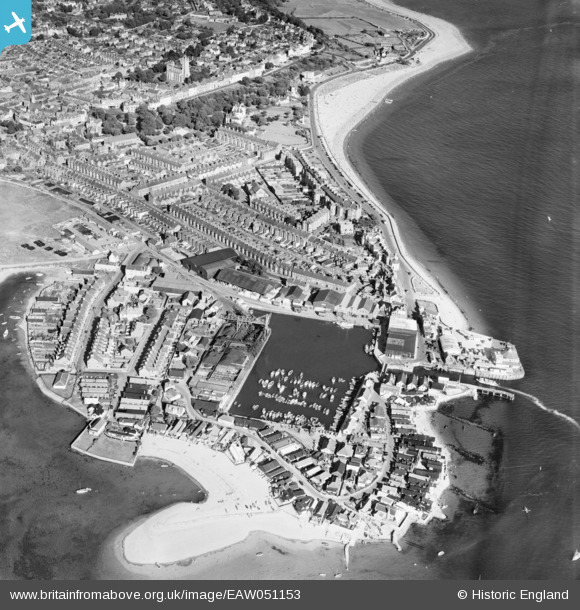
EAW051153 ENGLAND (1953). Exmouth Dock, The Point and environs, Exmouth, 1953
© Copyright OpenStreetMap contributors and licensed by the OpenStreetMap Foundation. 2026. Cartography is licensed as CC BY-SA.
Nearby Images (15)
EAW051153

EPW039693

EAW051152

EPW033465

EPW023666

EPW023676

EPW033462

EAW015002

EPW023667

EAW007590

EPW033463

EPW023675

EAW007589

EAW051154

EPW023674

Details
| Title | [EAW051153] Exmouth Dock, The Point and environs, Exmouth, 1953 |
| Reference | EAW051153 |
| Date | 10-August-1953 |
| Link | |
| Place name | EXMOUTH |
| Parish | EXMOUTH |
| District | |
| Country | ENGLAND |
| Easting / Northing | 299493, 80738 |
| Longitude / Latitude | -3.4208470883463, 50.617095443574 |
| National Grid Reference | SX995807 |
Pins
Be the first to add a comment to this image!