
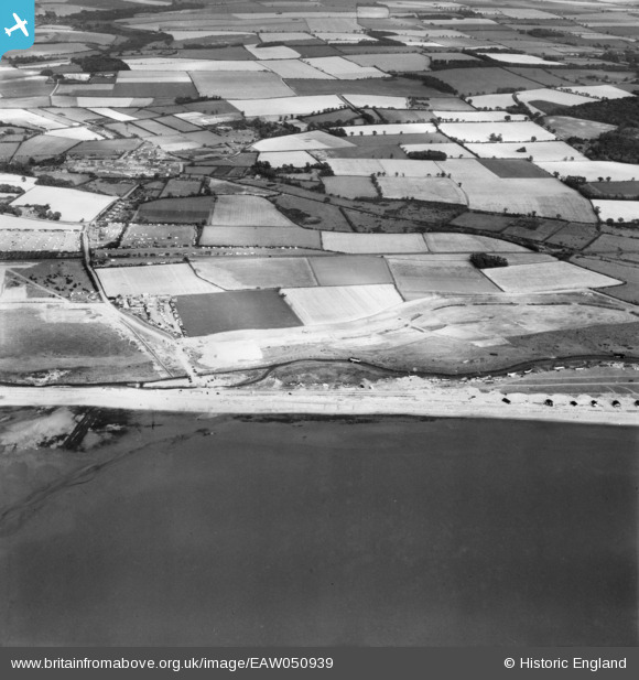
EAW050939 ENGLAND (1953). Stubborn Sand, adjacent Caravan Parks and the surrounding countryside, Heacham, 1953
© Copyright OpenStreetMap contributors and licensed by the OpenStreetMap Foundation. 2025. Cartography is licensed as CC BY-SA.
Nearby Images (2)
EAW050939

EAW050970

Details
| Title | [EAW050939] Stubborn Sand, adjacent Caravan Parks and the surrounding countryside, Heacham, 1953 |
| Reference | EAW050939 |
| Date | 30-July-1953 |
| Link | |
| Place name | HEACHAM |
| Parish | HEACHAM |
| District | |
| Country | ENGLAND |
| Easting / Northing | 566374, 336656 |
| Longitude / Latitude | 0.47391638471098, 52.901233025147 |
| National Grid Reference | TF664367 |
Pins

bandito |
Saturday 26th of September 2020 08:02:18 AM | |

Matt Aldred edob.mattaldred.com |
Monday 2nd of September 2019 04:14:35 PM | |
|
Matt Aldred edob.mattaldred.com |
Monday 2nd of September 2019 04:14:19 PM |