
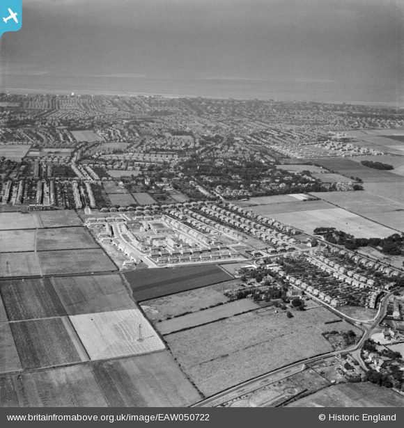
EAW050722 ENGLAND (1953). Thornton and Great Crosby, Crosby, from the north-east, 1953
© Copyright OpenStreetMap contributors and licensed by the OpenStreetMap Foundation. 2026. Cartography is licensed as CC BY-SA.
Nearby Images (2)
EAW050722

EAW050721

Details
| Title | [EAW050722] Thornton and Great Crosby, Crosby, from the north-east, 1953 |
| Reference | EAW050722 |
| Date | 29-June-1953 |
| Link | |
| Place name | CROSBY |
| Parish | |
| District | |
| Country | ENGLAND |
| Easting / Northing | 333594, 400640 |
| Longitude / Latitude | -3.0011724473742, 53.498012626457 |
| National Grid Reference | SD336006 |
Pins

rivermersey |
Saturday 18th of April 2020 01:00:38 PM | |
|
Lord Axminister |
Monday 15th of June 2015 12:50:17 AM | |
|
Lord Axminister |
Thursday 27th of November 2014 10:27:53 PM |