
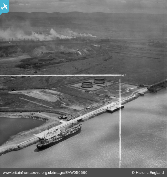
EAW050690 ENGLAND (1953). The Teesport Oil Depot and South Bank Iron Works, Teesport, from the north, 1953. This image was marked by Aerofilms Ltd for photo editing.
© Copyright OpenStreetMap contributors and licensed by the OpenStreetMap Foundation. 2026. Cartography is licensed as CC BY-SA.
Nearby Images (4)
EAW050690

EAW050688

EAW050691

EAW051067

Details
| Title | [EAW050690] The Teesport Oil Depot and South Bank Iron Works, Teesport, from the north, 1953. This image was marked by Aerofilms Ltd for photo editing. |
| Reference | EAW050690 |
| Date | 15-July-1953 |
| Link | |
| Place name | TEESPORT |
| Parish | |
| District | |
| Country | ENGLAND |
| Easting / Northing | 454119, 523308 |
| Longitude / Latitude | -1.1621575044672, 54.601923452939 |
| National Grid Reference | NZ541233 |
Pins

redmist |
Monday 28th of October 2019 09:37:08 PM | |
|
redmist |
Monday 28th of October 2019 09:36:38 PM |