
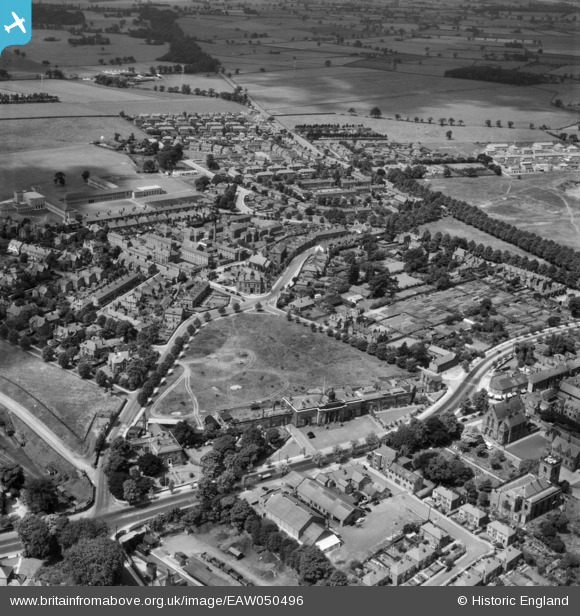
EAW050496 ENGLAND (1953). Stanley Park and environs, Knutsford, 1953
© Copyright OpenStreetMap contributors and licensed by the OpenStreetMap Foundation. 2026. Cartography is licensed as CC BY-SA.
Nearby Images (2)
EAW050496

EPW019444

Details
| Title | [EAW050496] Stanley Park and environs, Knutsford, 1953 |
| Reference | EAW050496 |
| Date | 8-July-1953 |
| Link | |
| Place name | KNUTSFORD |
| Parish | KNUTSFORD |
| District | |
| Country | ENGLAND |
| Easting / Northing | 374971, 378441 |
| Longitude / Latitude | -2.3756161419892, 53.302053545015 |
| National Grid Reference | SJ750784 |
Pins

WardyHeritage |
Thursday 22nd of April 2021 04:19:27 PM | |
|
WardyHeritage |
Thursday 22nd of April 2021 04:18:34 PM | |
|
WardyHeritage |
Thursday 22nd of April 2021 04:17:50 PM | |
|
WardyHeritage |
Thursday 22nd of April 2021 04:16:36 PM | |
|
Ian Warburton |
Sunday 28th of December 2014 10:50:28 PM | |
|
Ian Warburton |
Sunday 28th of December 2014 10:49:37 PM | |
|
Ian Warburton |
Sunday 28th of December 2014 10:48:26 PM | |
|
Ian Warburton |
Sunday 28th of December 2014 10:47:51 PM | |
|
Ian Warburton |
Sunday 28th of December 2014 10:46:51 PM | |
|
Ian Warburton |
Sunday 28th of December 2014 05:39:39 PM | |
|
Ian Warburton |
Sunday 28th of December 2014 05:38:41 PM | |
|
Ian Warburton |
Sunday 28th of December 2014 05:37:51 PM |