
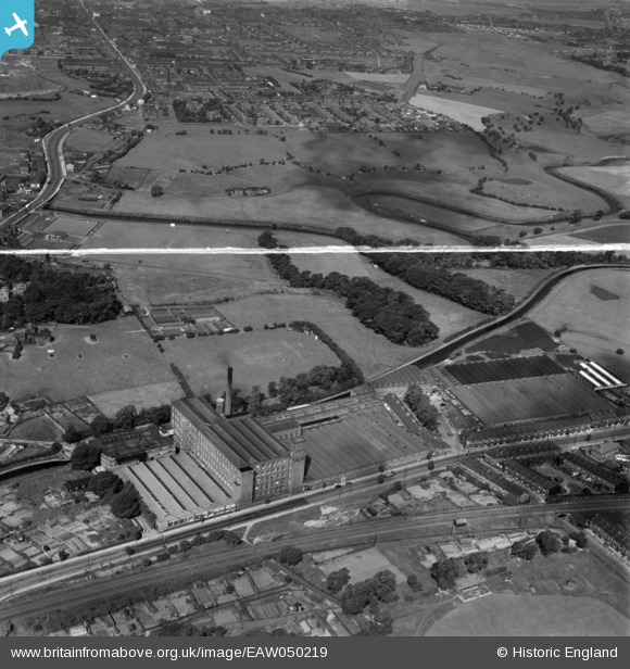
EAW050219 ENGLAND (1953). Throstle Bank Cotton Mill and environs, Hyde, 1953. This image was marked by Aerofilms Ltd for photo editing.
© Copyright OpenStreetMap contributors and licensed by the OpenStreetMap Foundation. 2025. Cartography is licensed as CC BY-SA.
Nearby Images (5)
EAW050219

EAW050220

EAW050221

EAW050218

EAW050222

Details
| Title | [EAW050219] Throstle Bank Cotton Mill and environs, Hyde, 1953. This image was marked by Aerofilms Ltd for photo editing. |
| Reference | EAW050219 |
| Date | 29-June-1953 |
| Link | |
| Place name | HYDE |
| Parish | |
| District | |
| Country | ENGLAND |
| Easting / Northing | 394060, 395562 |
| Longitude / Latitude | -2.0894659914889, 53.45652309196 |
| National Grid Reference | SJ941956 |
