
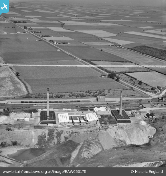
EAW050175 ENGLAND (1953). Warboys Brick Works and Puddock Road, Warboys, from the south-west, 1953. This image was marked by Aerofilms Ltd for photo editing.
© Copyright OpenStreetMap contributors and licensed by the OpenStreetMap Foundation. 2026. Cartography is licensed as CC BY-SA.
Nearby Images (8)
EAW050175

EAW050176

EAW050177

EAW050174

EAW050173

EAW050171

EAW050172

EAW050178

Details
| Title | [EAW050175] Warboys Brick Works and Puddock Road, Warboys, from the south-west, 1953. This image was marked by Aerofilms Ltd for photo editing. |
| Reference | EAW050175 |
| Date | 26-June-1953 |
| Link | |
| Place name | WARBOYS |
| Parish | WARBOYS |
| District | |
| Country | ENGLAND |
| Easting / Northing | 531085, 281815 |
| Longitude / Latitude | -0.072254963430013, 52.418221441733 |
| National Grid Reference | TL311818 |
Pins
Be the first to add a comment to this image!