
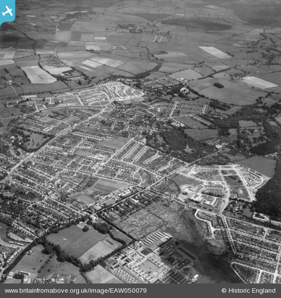
EAW050079 ENGLAND (1953). Housing development at Headington Quarry, New Headington, 1953
© Copyright OpenStreetMap contributors and licensed by the OpenStreetMap Foundation. 2026. Cartography is licensed as CC BY-SA.
Nearby Images (2)
EAW050079

EPW047769

Details
| Title | [EAW050079] Housing development at Headington Quarry, New Headington, 1953 |
| Reference | EAW050079 |
| Date | 26-June-1953 |
| Link | |
| Place name | NEW HEADINGTON |
| Parish | |
| District | |
| Country | ENGLAND |
| Easting / Northing | 455323, 206840 |
| Longitude / Latitude | -1.198384593426, 51.757058892299 |
| National Grid Reference | SP553068 |
Pins

David Brimson |
Monday 4th of August 2025 04:33:58 PM | |
|
David Brimson |
Monday 4th of August 2025 04:32:00 PM | |
|
David Brimson |
Monday 4th of August 2025 04:14:41 PM | |
|
David Brimson |
Monday 4th of August 2025 04:13:57 PM | |
|
felix |
Sunday 21st of February 2021 09:30:29 PM | |
|
felix |
Sunday 21st of February 2021 09:29:58 PM | |
|
felix |
Sunday 21st of February 2021 09:29:04 PM | |
|
Stephanie (Oxford) |
Sunday 24th of June 2018 07:26:59 PM | |
|
Louis |
Wednesday 12th of November 2014 08:01:36 PM |