
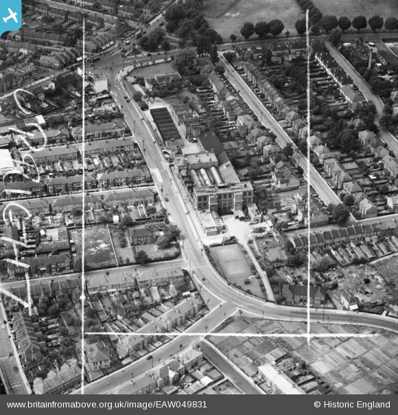
EAW049831 ENGLAND (1953). The Confectionery Works on Lock's Lane, Mitcham, 1953. This image was marked by Aerofilms Ltd for photo editing.
© Copyright OpenStreetMap contributors and licensed by the OpenStreetMap Foundation. 2026. Cartography is licensed as CC BY-SA.
Nearby Images (13)
EAW049831

EPW025107

EPW025106

EPW025109

EAW049828

EAW049832

EAW049833

EAW049827

EAW049829

EAW049830

EAW047585

EAW047586

EAW047588

Details
| Title | [EAW049831] The Confectionery Works on Lock's Lane, Mitcham, 1953. This image was marked by Aerofilms Ltd for photo editing. |
| Reference | EAW049831 |
| Date | 6-June-1953 |
| Link | |
| Place name | MITCHAM |
| Parish | |
| District | |
| Country | ENGLAND |
| Easting / Northing | 528129, 169419 |
| Longitude / Latitude | -0.15752692984018, 51.408806305046 |
| National Grid Reference | TQ281694 |
Pins

Laurie |
Monday 3rd of November 2014 11:48:15 PM |
User Comment Contributions

1953 view from east |
Wade |
Saturday 17th of January 2015 08:26:17 AM |