
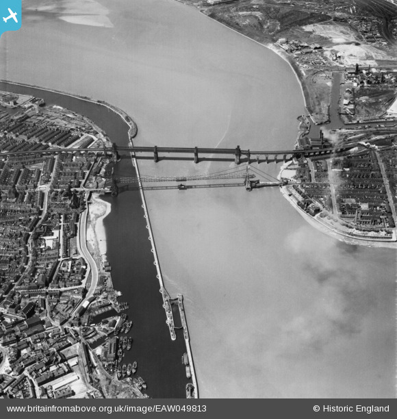
EAW049813 ENGLAND (1953). The Widnes Transporter Bridge and Runcorn Railway Bridge crossing the River Mersey and Manchester Ship Canal, Runcorn Gap, 1953
© Copyright OpenStreetMap contributors and licensed by the OpenStreetMap Foundation. 2026. Cartography is licensed as CC BY-SA.
Nearby Images (35)
EAW049813

EAW008430

EAW049809

EAW005676

EAW049818

EPW018913

EAW049814

EAW049808

EAW044937

EPW005875

EAW049800

EAW049804

EAW044939

EAW049815

EAW049803

EAW044938

EAW049806

EAW044943

EAW049807

EAW049801

EAW008431

EAW049798

EAW049816

EAW044941

EAW049817

EAW049812

EAW044942

EAW044940

EAW049797

EAW049802

EAW049799

EAW005675

EAW049805

EPW014298

EAW049811

Details
| Title | [EAW049813] The Widnes Transporter Bridge and Runcorn Railway Bridge crossing the River Mersey and Manchester Ship Canal, Runcorn Gap, 1953 |
| Reference | EAW049813 |
| Date | 30-May-1953 |
| Link | |
| Place name | RUNCORN GAP |
| Parish | |
| District | |
| Country | ENGLAND |
| Easting / Northing | 351087, 383512 |
| Longitude / Latitude | -2.7348073413679, 53.345969694604 |
| National Grid Reference | SJ511835 |
Pins

Bottom Yard |
Tuesday 12th of November 2024 02:05:06 PM | |
|
Bottom Yard |
Tuesday 12th of November 2024 01:57:52 PM | |
|
Bottom Yard |
Tuesday 12th of November 2024 01:54:36 PM | |

Ginger79 |
Sunday 27th of November 2022 09:57:24 AM | |
|
redmist |
Thursday 28th of March 2019 10:07:53 AM | |
|
redmist |
Thursday 28th of March 2019 10:03:49 AM | |
|
John Wass |
Sunday 3rd of May 2015 05:01:21 PM |