
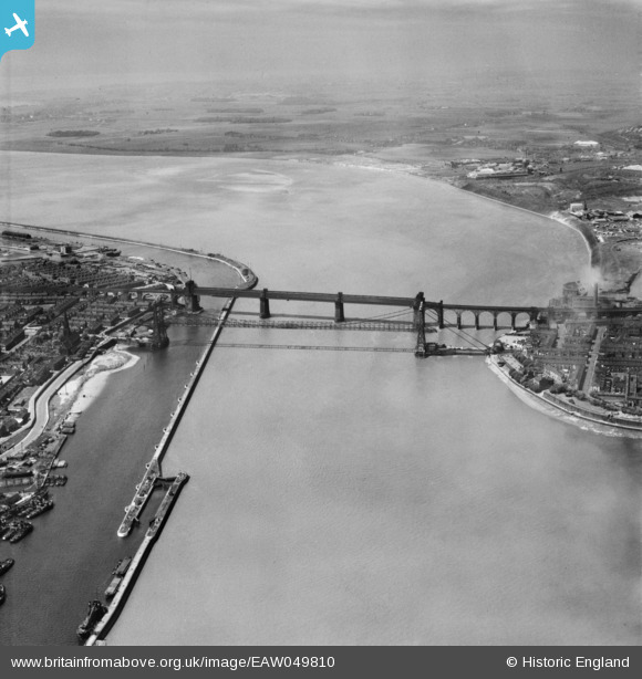
EAW049810 ENGLAND (1953). The Widnes Transporter Bridge and Runcorn Railway Bridge crossing the River Mersey and Manchester Ship Canal, Runcorn Gap, from the east, 1953
© Copyright OpenStreetMap contributors and licensed by the OpenStreetMap Foundation. 2026. Cartography is licensed as CC BY-SA.
Nearby Images (2)
EAW049810

EAW049811

Details
| Title | [EAW049810] The Widnes Transporter Bridge and Runcorn Railway Bridge crossing the River Mersey and Manchester Ship Canal, Runcorn Gap, from the east, 1953 |
| Reference | EAW049810 |
| Date | 30-May-1953 |
| Link | |
| Place name | RUNCORN GAP |
| Parish | |
| District | |
| Country | ENGLAND |
| Easting / Northing | 351426, 383464 |
| Longitude / Latitude | -2.7297077190931, 53.345569469887 |
| National Grid Reference | SJ514835 |
Pins

Bottom Yard |
Tuesday 12th of November 2024 01:20:50 PM | |
|
Bottom Yard |
Tuesday 12th of November 2024 01:19:02 PM | |
|
Bottom Yard |
Tuesday 12th of November 2024 01:17:26 PM | |
|
Bottom Yard |
Tuesday 12th of November 2024 01:12:15 PM | |
|
Bottom Yard |
Tuesday 12th of November 2024 01:05:50 PM | |

Ginger79 |
Sunday 9th of August 2020 01:48:45 PM |