
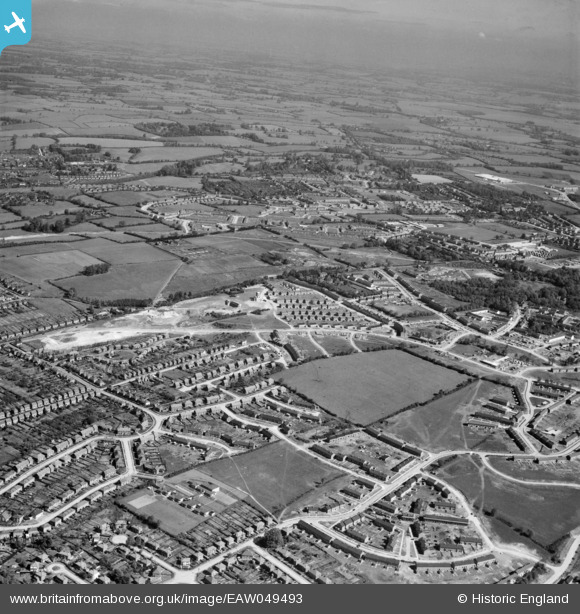
EAW049493 ENGLAND (1953). New housing development at Bennetts End, Hemel Hempstead, from the south, 1953
© Copyright OpenStreetMap contributors and licensed by the OpenStreetMap Foundation. 2026. Cartography is licensed as CC BY-SA.
Nearby Images (5)
EAW049493

EAW049494

EAW049491

EAW049490

EAW049492

Details
| Title | [EAW049493] New housing development at Bennetts End, Hemel Hempstead, from the south, 1953 |
| Reference | EAW049493 |
| Date | 19-May-1953 |
| Link | |
| Place name | HEMEL HEMPSTEAD |
| Parish | |
| District | |
| Country | ENGLAND |
| Easting / Northing | 506793, 205593 |
| Longitude / Latitude | -0.45320364683523, 51.738399901197 |
| National Grid Reference | TL068056 |
Pins

Baz 1969 |
Tuesday 1st of December 2020 12:55:25 PM | |
|
Baz 1969 |
Tuesday 1st of December 2020 12:51:33 PM | |
|
H.E. |
Wednesday 28th of February 2018 02:42:20 PM | |
|
H.E. |
Wednesday 28th of February 2018 02:41:00 PM | |
|
H.E. |
Wednesday 28th of February 2018 02:39:34 PM | |
|
H.E. |
Wednesday 28th of February 2018 02:38:31 PM | |
|
H.E. |
Wednesday 14th of January 2015 09:26:30 PM |
