
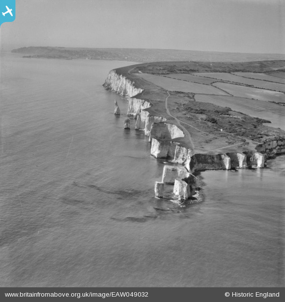
EAW049032 ENGLAND (1953). Handfast Point, The Pinnacles and Ballard Point, Studland, from the north-east, 1953
© Copyright OpenStreetMap contributors and licensed by the OpenStreetMap Foundation. 2026. Cartography is licensed as CC BY-SA.
Nearby Images (3)
EAW049032

EAW049034

EAW049033

Details
| Title | [EAW049032] Handfast Point, The Pinnacles and Ballard Point, Studland, from the north-east, 1953 |
| Reference | EAW049032 |
| Date | 4-May-1953 |
| Link | |
| Place name | STUDLAND |
| Parish | STUDLAND |
| District | |
| Country | ENGLAND |
| Easting / Northing | 405618, 82546 |
| Longitude / Latitude | -1.9205390888911, 50.64199312628 |
| National Grid Reference | SZ056825 |
Pins

Sparky |
Thursday 26th of October 2017 07:17:30 PM |