
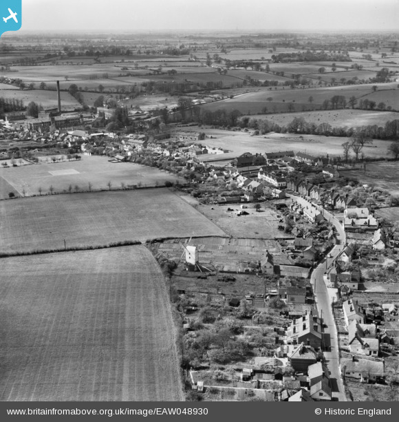
EAW048930 ENGLAND (1953). Bocking Windmill and Church Street, Bocking Churchstreet, from the north-east, 1953
© Copyright OpenStreetMap contributors and licensed by the OpenStreetMap Foundation. 2026. Cartography is licensed as CC BY-SA.
Nearby Images (2)
EAW048930

EAW048929

Details
| Title | [EAW048930] Bocking Windmill and Church Street, Bocking Churchstreet, from the north-east, 1953 |
| Reference | EAW048930 |
| Date | 2-May-1953 |
| Link | |
| Place name | BOCKING CHURCHSTREET |
| Parish | |
| District | |
| Country | ENGLAND |
| Easting / Northing | 576336, 225982 |
| Longitude / Latitude | 0.56357336791711, 51.903992753662 |
| National Grid Reference | TL763260 |
Pins

woodsy007 |
Saturday 26th of July 2014 10:38:20 PM | |
|
woodsy007 |
Saturday 26th of July 2014 10:37:47 PM | |
|
woodsy007 |
Saturday 26th of July 2014 10:36:29 PM | |
|
woodsy007 |
Saturday 26th of July 2014 10:35:20 PM | |
|
woodsy007 |
Saturday 26th of July 2014 10:32:59 PM | |
|
woodsy007 |
Saturday 26th of July 2014 10:31:35 PM | |
|
woodsy007 |
Saturday 26th of July 2014 10:30:30 PM | |
|
PatsyP |
Thursday 24th of July 2014 12:53:36 PM | |
|
PatsyP |
Thursday 24th of July 2014 12:50:48 PM | |

Maurice |
Tuesday 22nd of July 2014 06:32:30 PM |