
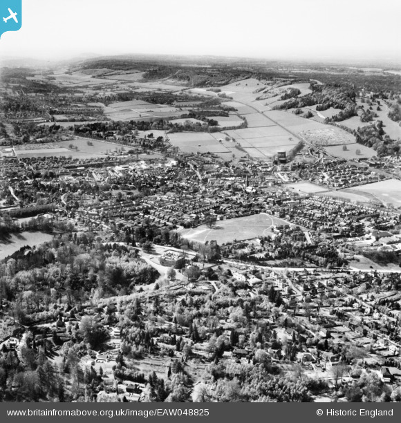
EAW048825 ENGLAND (1953). Deepdene House and the town, Dorking, from the east, 1953
© Copyright OpenStreetMap contributors and licensed by the OpenStreetMap Foundation. 2026. Cartography is licensed as CC BY-SA.
Nearby Images (2)
EAW048825

EPW006243

Details
| Title | [EAW048825] Deepdene House and the town, Dorking, from the east, 1953 |
| Reference | EAW048825 |
| Date | 26-April-1953 |
| Link | |
| Place name | DORKING |
| Parish | |
| District | |
| Country | ENGLAND |
| Easting / Northing | 517317, 149286 |
| Longitude / Latitude | -0.31955364326466, 51.230173273666 |
| National Grid Reference | TQ173493 |
Pins

cptpies |
Monday 26th of April 2021 02:42:54 PM | |
|
DGY |
Saturday 13th of March 2021 06:34:48 PM | |
|
rog8811 |
Saturday 31st of October 2015 09:38:52 PM | |
|
Dan Gregory |
Thursday 3rd of July 2014 05:26:01 PM | |
|
Dan Gregory |
Thursday 3rd of July 2014 05:25:16 PM | |
|
Dan Gregory |
Thursday 3rd of July 2014 05:23:28 PM | |
|
Dan Gregory |
Thursday 3rd of July 2014 05:22:45 PM | |

Maurice |
Sunday 22nd of June 2014 09:24:51 PM | |
|
Maurice |
Sunday 22nd of June 2014 09:24:27 PM | |
|
Maurice |
Sunday 22nd of June 2014 09:16:16 PM | |
|
Maurice |
Sunday 22nd of June 2014 09:15:34 PM | |
|
Maurice |
Sunday 22nd of June 2014 09:13:59 PM |
