
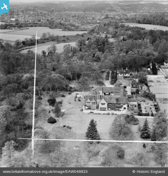
EAW048815 ENGLAND (1953). Orchards House, Bramley, 1953. This image was marked by Aerofilms Ltd for photo editing.
© Copyright OpenStreetMap contributors and licensed by the OpenStreetMap Foundation. 2025. Cartography is licensed as CC BY-SA.
Nearby Images (9)
EAW048815

EAW048817

EAW048813

EAW048810

EAW048818

EAW048814

EAW048811

EAW048812

EAW048816

Details
| Title | [EAW048815] Orchards House, Bramley, 1953. This image was marked by Aerofilms Ltd for photo editing. |
| Reference | EAW048815 |
| Date | 26-April-1953 |
| Link | |
| Place name | BRAMLEY |
| Parish | BRAMLEY |
| District | |
| Country | ENGLAND |
| Easting / Northing | 499220, 143275 |
| Longitude / Latitude | -0.58034405330168, 51.179567477469 |
| National Grid Reference | SU992433 |
Pins
Be the first to add a comment to this image!