
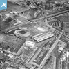
EAW048652 ENGLAND (1953). The Rotherham Forge & Rolling Mills Co Ltd Works on Greasbrough Street and environs, Rotherham, 1953

© Copyright OpenStreetMap contributors and licensed by the OpenStreetMap Foundation. 2026. Cartography is licensed as CC BY-SA.
Nearby Images (7)
EAW048652
 0°
0m
0°
0m
EAW048654
 351°
18m
351°
18m
EAW048650
 128°
67m
128°
67m
EAW048651
 279°
67m
279°
67m
EAW048656
 151°
79m
151°
79m
EAW048655
 150°
98m
150°
98m
EAW048653
 132°
143m
132°
143m
Details
| Title | [EAW048652] The Rotherham Forge & Rolling Mills Co Ltd Works on Greasbrough Street and environs, Rotherham, 1953 |
| Reference | EAW048652 |
| Date | 3-April-1953 |
| Link | |
| Place name | ROTHERHAM |
| Parish | |
| District | |
| Country | ENGLAND |
| Easting / Northing | 442451, 393578 |
| Longitude / Latitude | -1.3609085444679, 53.437011836483 |
| National Grid Reference | SK425936 |
Pins
 Car House. Former seat of 'Coal King', William Fenton in the 18th century. Car House. Former seat of 'Coal King', William Fenton in the 18th century. |

Gavin Thomas |
Monday 12th of October 2026 10:07:48 PM |