
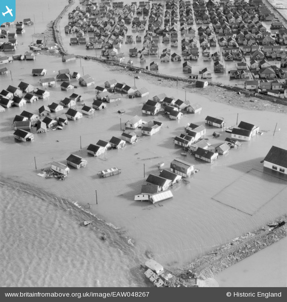
EAW048267 ENGLAND (1953). Flooding at Belsize Avenue, Lincoln Avenue and Napier Avenue, Jaywick, 1953
© Copyright OpenStreetMap contributors and licensed by the OpenStreetMap Foundation. 2026. Cartography is licensed as CC BY-SA.
Nearby Images (6)
EAW048267

EAW048281

EAW048271

EAW048269

EAW048272

EAW048270

Details
| Title | [EAW048267] Flooding at Belsize Avenue, Lincoln Avenue and Napier Avenue, Jaywick, 1953 |
| Reference | EAW048267 |
| Date | 2-February-1953 |
| Link | |
| Place name | JAYWICK |
| Parish | |
| District | |
| Country | ENGLAND |
| Easting / Northing | 613902, 212824 |
| Longitude / Latitude | 1.1007837708264, 51.772697107399 |
| National Grid Reference | TM139128 |
Pins

Billy Turner |
Friday 18th of December 2015 10:14:15 PM |
