
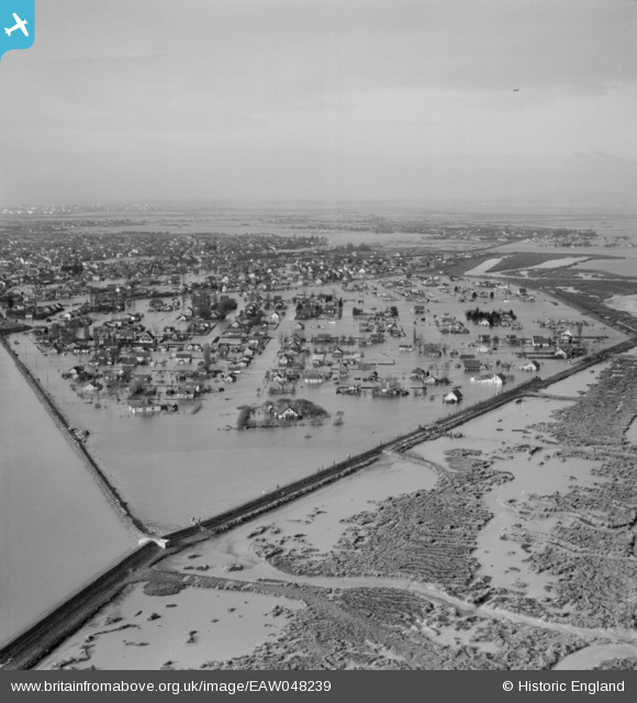
EAW048239 ENGLAND (1953). Extensive flooding at Sunken Marsh, Canvey Island, from the north-east, 1953
© Copyright OpenStreetMap contributors and licensed by the OpenStreetMap Foundation. 2026. Cartography is licensed as CC BY-SA.
Nearby Images (4)
EAW048239

EAW048249

EAW048242

EAW048246

Details
| Title | [EAW048239] Extensive flooding at Sunken Marsh, Canvey Island, from the north-east, 1953 |
| Reference | EAW048239 |
| Date | 2-February-1953 |
| Link | |
| Place name | CANVEY ISLAND |
| Parish | CANVEY ISLAND |
| District | |
| Country | ENGLAND |
| Easting / Northing | 581105, 184214 |
| Longitude / Latitude | 0.61111573171133, 51.527271259868 |
| National Grid Reference | TQ811842 |
Pins

Matt Aldred edob.mattaldred.com |
Sunday 26th of July 2026 04:31:39 PM |