
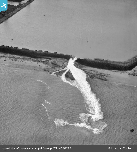
EAW048222 ENGLAND (1953). Flood water pouring into the River Thames to the west of Littlebrook Power Station, Dartford, 1953
© Copyright OpenStreetMap contributors and licensed by the OpenStreetMap Foundation. 2025. Cartography is licensed as CC BY-SA.
Nearby Images (3)
EAW048222

EAW048221

EAW048217

Details
| Title | [EAW048222] Flood water pouring into the River Thames to the west of Littlebrook Power Station, Dartford, 1953 |
| Reference | EAW048222 |
| Date | 2-February-1953 |
| Link | |
| Place name | DARTFORD |
| Parish | |
| District | |
| Country | ENGLAND |
| Easting / Northing | 555924, 176721 |
| Longitude / Latitude | 0.24507652730513, 51.467458392348 |
| National Grid Reference | TQ559767 |
Pins
Be the first to add a comment to this image!