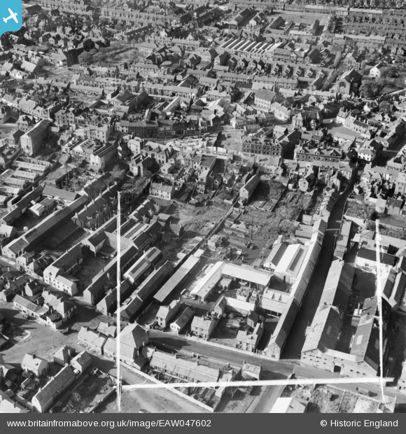
EAW047602 ENGLAND (1952). Rant Score and environs, Lowestoft, 1952. This image was marked by Aerofilms Ltd for photo editing.
© Copyright OpenStreetMap contributors and licensed by the OpenStreetMap Foundation. 2026. Cartography is licensed as CC BY-SA.
Nearby Images (12)
Details
| Title | [EAW047602] Rant Score and environs, Lowestoft, 1952. This image was marked by Aerofilms Ltd for photo editing. |
| Reference | EAW047602 |
| Date | 23-October-1952 |
| Link | |
| Place name | LOWESTOFT |
| Parish | |
| District | |
| Country | ENGLAND |
| Easting / Northing | 655170, 293593 |
| Longitude / Latitude | 1.7583254271394, 52.480115376674 |
| National Grid Reference | TM552936 |
Pins

Harvey |
Saturday 1st of July 2023 02:42:05 PM |


![[EAW047602] Rant Score and environs, Lowestoft, 1952. This image was marked by Aerofilms Ltd for photo editing.](http://britainfromabove.org.uk/sites/all/libraries/aerofilms-images/public/100x100/EAW/047/EAW047602.jpg)
![[EAW047607] Rant Score and environs, Lowestoft, 1952. This image was marked by Aerofilms Ltd for photo editing.](http://britainfromabove.org.uk/sites/all/libraries/aerofilms-images/public/100x100/EAW/047/EAW047607.jpg)
![[EAW047604] Rant Score and environs, Lowestoft, 1952](http://britainfromabove.org.uk/sites/all/libraries/aerofilms-images/public/100x100/EAW/047/EAW047604.jpg)
![[EAW047600] Rant Score and environs, Lowestoft, 1952. This image was marked by Aerofilms Ltd for photo editing.](http://britainfromabove.org.uk/sites/all/libraries/aerofilms-images/public/100x100/EAW/047/EAW047600.jpg)
![[EAW047606] Rant Score and environs, Lowestoft, 1952. This image was marked by Aerofilms Ltd for photo editing.](http://britainfromabove.org.uk/sites/all/libraries/aerofilms-images/public/100x100/EAW/047/EAW047606.jpg)
![[EAW047599] Whapload Road and environs, Lowestoft, 1952. This image was marked by Aerofilms Ltd for photo editing.](http://britainfromabove.org.uk/sites/all/libraries/aerofilms-images/public/100x100/EAW/047/EAW047599.jpg)
![[EAW047603] Rant Score and environs, Lowestoft, 1952. This image was marked by Aerofilms Ltd for photo editing.](http://britainfromabove.org.uk/sites/all/libraries/aerofilms-images/public/100x100/EAW/047/EAW047603.jpg)
![[EAW047598] Rant Score and environs, Lowestoft, 1952. This image was marked by Aerofilms Ltd for photo editing.](http://britainfromabove.org.uk/sites/all/libraries/aerofilms-images/public/100x100/EAW/047/EAW047598.jpg)
![[EAW047601] Rant Score and environs, Lowestoft, 1952. This image was marked by Aerofilms Ltd for photo editing.](http://britainfromabove.org.uk/sites/all/libraries/aerofilms-images/public/100x100/EAW/047/EAW047601.jpg)
![[EAW047605] Rant Score and environs, Lowestoft, 1952. This image was marked by Aerofilms Ltd for photo editing.](http://britainfromabove.org.uk/sites/all/libraries/aerofilms-images/public/100x100/EAW/047/EAW047605.jpg)
![[EPW021249] Old Market Plain and St Peter's Church, Lowestoft, 1928](http://britainfromabove.org.uk/sites/all/libraries/aerofilms-images/public/100x100/EPW/021/EPW021249.jpg)
![[EPW060824] Lowestoft Water and Gas Co Gas Works on Ness Point and environs, Lowestoft, 1939](http://britainfromabove.org.uk/sites/all/libraries/aerofilms-images/public/100x100/EPW/060/EPW060824.jpg)
