
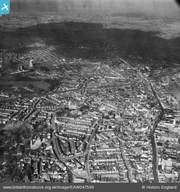
EAW047596 ENGLAND (1952). The town centre, Croydon, from the south, 1952
© Copyright OpenStreetMap contributors and licensed by the OpenStreetMap Foundation. 2026. Cartography is licensed as CC BY-SA.
Nearby Images (7)
EAW047596

EAW047595

EPW052806

EAW047591

EPW021425

EPW052805

EAW047593

Details
| Title | [EAW047596] The town centre, Croydon, from the south, 1952 |
| Reference | EAW047596 |
| Date | 23-October-1952 |
| Link | |
| Place name | CROYDON |
| Parish | |
| District | |
| Country | ENGLAND |
| Easting / Northing | 532083, 165271 |
| Longitude / Latitude | -0.10224556172145, 51.370617851671 |
| National Grid Reference | TQ321653 |
Pins

brianbeckett |
Saturday 18th of October 2014 05:46:37 PM | |
|
brianbeckett |
Saturday 18th of October 2014 05:44:42 PM | |
|
brianbeckett |
Saturday 18th of October 2014 05:44:05 PM |