
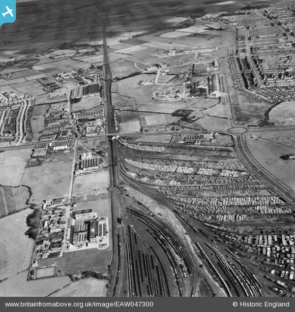
EAW047300 ENGLAND (1952). Speke Industrial Estate, Speke Sidings and environs, Speke, 1952
© Copyright OpenStreetMap contributors and licensed by the OpenStreetMap Foundation. 2026. Cartography is licensed as CC BY-SA.
Nearby Images (10)
EAW047300

EAW047299

EAW046239

EAW046234

EAW046238

EAW046236

EAW046235

EAW046237

EAW046232

EAW046233

Details
| Title | [EAW047300] Speke Industrial Estate, Speke Sidings and environs, Speke, 1952 |
| Reference | EAW047300 |
| Date | 4-October-1952 |
| Link | |
| Place name | SPEKE |
| Parish | |
| District | |
| Country | ENGLAND |
| Easting / Northing | 342396, 384299 |
| Longitude / Latitude | -2.865498165108, 53.352168543099 |
| National Grid Reference | SJ424843 |
Pins

Hamilton163 |
Sunday 28th of August 2022 11:16:22 AM | |
|
Hamilton163 |
Sunday 28th of August 2022 11:15:07 AM | |
|
Hamilton163 |
Sunday 28th of August 2022 11:14:24 AM | |
|
Hamilton163 |
Sunday 28th of August 2022 11:13:14 AM | |
|
Hamilton163 |
Sunday 28th of August 2022 11:10:59 AM | |
|
John Wass |
Saturday 9th of May 2015 12:10:49 PM | |
|
beast66606 |
Wednesday 18th of June 2014 10:29:20 PM |