
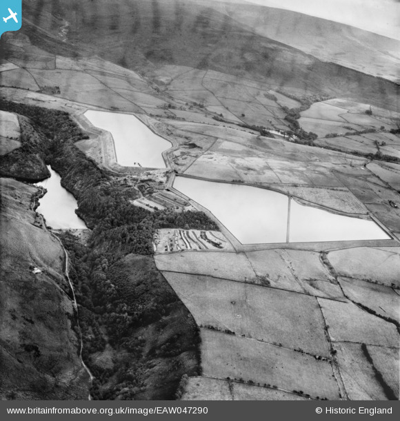
EAW047290 ENGLAND (1952). The Grizedale, Grizedale Lea and Barnacre Reservoirs, Calder Vale, 1952
© Copyright OpenStreetMap contributors and licensed by the OpenStreetMap Foundation. 2025. Cartography is licensed as CC BY-SA.
Nearby Images (4)
EAW047290

EAW047291

EAW047289

EAW047288

Details
| Title | [EAW047290] The Grizedale, Grizedale Lea and Barnacre Reservoirs, Calder Vale, 1952 |
| Reference | EAW047290 |
| Date | 4-October-1952 |
| Link | |
| Place name | CALDER VALE |
| Parish | BARNACRE-WITH-BONDS |
| District | |
| Country | ENGLAND |
| Easting / Northing | 352568, 448009 |
| Longitude / Latitude | -2.7223976647977, 53.925839215469 |
| National Grid Reference | SD526480 |
Pins

totoro |
Saturday 31st of December 2016 09:29:44 PM | |
|
totoro |
Saturday 31st of December 2016 09:28:29 PM | |
|
totoro |
Saturday 31st of December 2016 09:26:56 PM | |
|
totoro |
Saturday 31st of December 2016 09:25:41 PM | |
|
totoro |
Saturday 31st of December 2016 09:24:03 PM |