
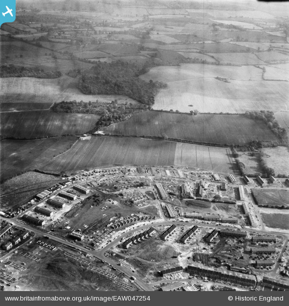
EAW047254 ENGLAND (1952). The residential area at Bedwell East under construction, Bedwell, from the west, 1952
© Copyright OpenStreetMap contributors and licensed by the OpenStreetMap Foundation. 2026. Cartography is licensed as CC BY-SA.
Nearby Images (7)
EAW047254

EAW047255

EAW047253

EAW047256

EAW047257

EAW047259

EAW047258

Details
| Title | [EAW047254] The residential area at Bedwell East under construction, Bedwell, from the west, 1952 |
| Reference | EAW047254 |
| Date | 15-October-1952 |
| Link | |
| Place name | BEDWELL |
| Parish | |
| District | |
| Country | ENGLAND |
| Easting / Northing | 524974, 224134 |
| Longitude / Latitude | -0.18330899460005, 51.901277626595 |
| National Grid Reference | TL250241 |
Pins
Be the first to add a comment to this image!