
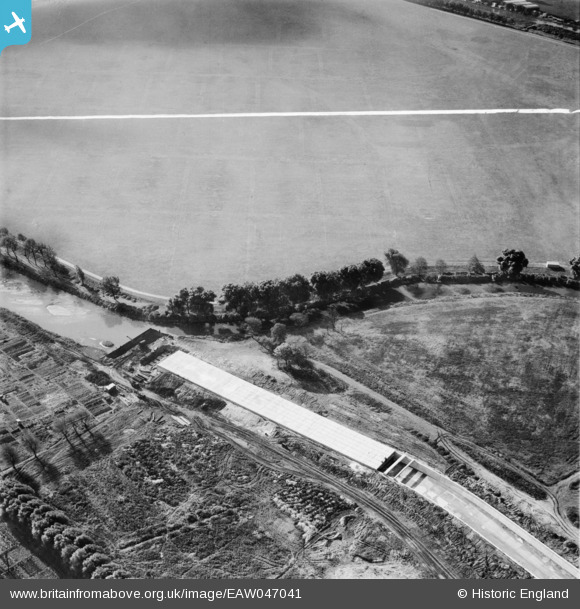
EAW047041 ENGLAND (1952). A culverted section of the Lee Flood Relief Channel under construction, Leyton, 1952. This image was marked by Aerofilms Ltd for photo editing.
© Copyright OpenStreetMap contributors and licensed by the OpenStreetMap Foundation. 2026. Cartography is licensed as CC BY-SA.
Nearby Images (10)
EAW047041

EAW047034

EAW047033

EAW047040

EAW047032

EAW047035

EAW047036

EAW047039

EAW047037

EAW047038

Details
| Title | [EAW047041] A culverted section of the Lee Flood Relief Channel under construction, Leyton, 1952. This image was marked by Aerofilms Ltd for photo editing. |
| Reference | EAW047041 |
| Date | 26-September-1952 |
| Link | |
| Place name | LEYTON |
| Parish | |
| District | |
| Country | ENGLAND |
| Easting / Northing | 536571, 186536 |
| Longitude / Latitude | -0.029585387344143, 51.560670125187 |
| National Grid Reference | TQ366865 |
Pins
Be the first to add a comment to this image!