
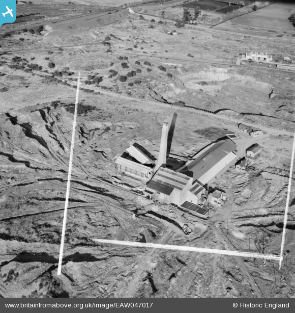
EAW047017 ENGLAND (1952). The Rubery, Owen and Co Brick Works, Pouk Hill, 1952. This image was marked by Aerofilms Ltd for photo editing.
© Copyright OpenStreetMap contributors and licensed by the OpenStreetMap Foundation. 2026. Cartography is licensed as CC BY-SA.
Nearby Images (8)
EAW047017

 0°
0m
0°
0m
EAW047019
 337°
47m
337°
47m
EAW047022
 307°
59m
307°
59m
EAW047023
 96°
72m
96°
72m
EAW047021
 278°
81m
278°
81m
EAW047016
 141°
86m
141°
86m
EAW047018
 133°
86m
133°
86m
EAW047020
 337°
90m
337°
90m
Details
| Title | [EAW047017] The Rubery, Owen and Co Brick Works, Pouk Hill, 1952. This image was marked by Aerofilms Ltd for photo editing. |
| Reference | EAW047017 |
| Date | 23-September-1952 |
| Link | |
| Place name | POUK HILL |
| Parish | |
| District | |
| Country | ENGLAND |
| Easting / Northing | 399013, 299467 |
| Longitude / Latitude | -2.0145717560153, 52.592644277252 |
| National Grid Reference | SO990995 |
Pins
Be the first to add a comment to this image!