
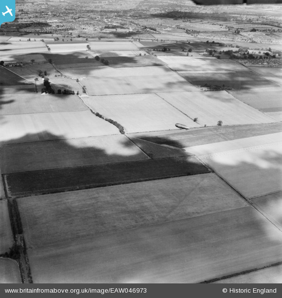
EAW046973 ENGLAND (1952). An airship in flight south-west of Shortstown, Wilstead, 1952
© Copyright OpenStreetMap contributors and licensed by the OpenStreetMap Foundation. 2026. Cartography is licensed as CC BY-SA.
Nearby Images (2)
EAW046973

EAW046972

Details
| Title | [EAW046973] An airship in flight south-west of Shortstown, Wilstead, 1952 |
| Reference | EAW046973 |
| Date | 20-September-1952 |
| Link | |
| Place name | WILSTEAD |
| Parish | WILSHAMSTEAD |
| District | |
| Country | ENGLAND |
| Easting / Northing | 506861, 245593 |
| Longitude / Latitude | -0.43980295715369, 52.097929159599 |
| National Grid Reference | TL069456 |
Pins

mdh335 |
Friday 14th of June 2024 03:57:16 PM | |
|
BallisticBerry |
Friday 3rd of July 2020 02:32:25 AM | |
|
BallisticBerry |
Friday 3rd of July 2020 02:32:12 AM | |
|
brian |
Monday 23rd of February 2015 01:13:34 AM | |

melgibbs |
Thursday 31st of July 2014 12:34:33 PM | |
|
melgibbs |
Thursday 31st of July 2014 12:33:55 PM | |
|
melgibbs |
Thursday 31st of July 2014 12:32:53 PM |
User Comment Contributions
I believe this airship is the Bournmouth, a very rare shot as this airship didn't make too many flights. |
Trev |
Friday 25th of July 2014 11:39:32 AM |