
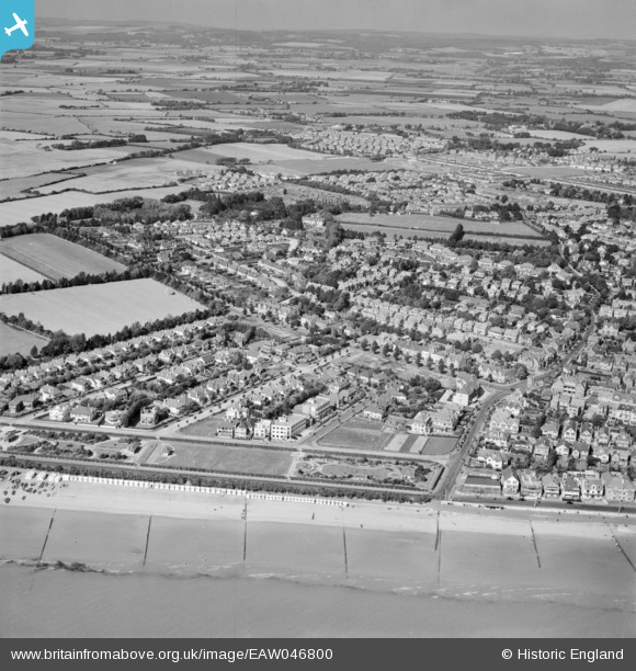
EAW046800 ENGLAND (1952). Marine Park Gardens and the town, Bognor Regis, from the south, 1952
© Copyright OpenStreetMap contributors and licensed by the OpenStreetMap Foundation. 2026. Cartography is licensed as CC BY-SA.
Nearby Images (5)
EAW046800

EAW022234

EPW040101

EPW000770

EAW046801

Details
| Title | [EAW046800] Marine Park Gardens and the town, Bognor Regis, from the south, 1952 |
| Reference | EAW046800 |
| Date | 16-September-1952 |
| Link | |
| Place name | BOGNOR REGIS |
| Parish | ALDWICK |
| District | |
| Country | ENGLAND |
| Easting / Northing | 492493, 98678 |
| Longitude / Latitude | -0.68791851040675, 50.779727304639 |
| National Grid Reference | SZ925987 |
Pins

David |
Friday 3rd of April 2015 11:12:31 AM | |
|
Richard Dawson |
Friday 12th of September 2014 06:10:21 PM | |
|
Richard Dawson |
Friday 12th of September 2014 06:08:59 PM | |
|
Richard Dawson |
Friday 12th of September 2014 06:08:07 PM | |
|
Richard Dawson |
Friday 12th of September 2014 06:07:27 PM | |
|
Richard Dawson |
Friday 12th of September 2014 06:06:50 PM | |
|
Richard Dawson |
Friday 12th of September 2014 06:06:17 PM | |
|
Richard Dawson |
Friday 12th of September 2014 06:05:39 PM | |
|
Richard Dawson |
Friday 12th of September 2014 06:05:01 PM | |
|
Richard Dawson |
Friday 12th of September 2014 06:04:04 PM | |
|
Richard Dawson |
Friday 12th of September 2014 06:03:26 PM | |
|
Richard Dawson |
Friday 12th of September 2014 06:02:55 PM |