
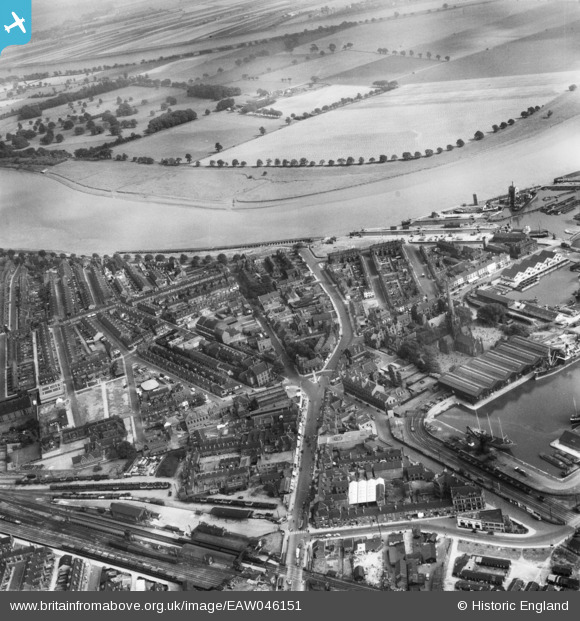
EAW046151 ENGLAND (1952). North Street, Victoria Street and the River Ouse, Goole, 1952
© Copyright OpenStreetMap contributors and licensed by the OpenStreetMap Foundation. 2026. Cartography is licensed as CC BY-SA.
Nearby Images (6)
EAW046151

EPW031441

EPW012842

EPW012839

EPW031440

EPW031431

Details
| Title | [EAW046151] North Street, Victoria Street and the River Ouse, Goole, 1952 |
| Reference | EAW046151 |
| Date | 22-August-1952 |
| Link | |
| Place name | GOOLE |
| Parish | GOOLE |
| District | |
| Country | ENGLAND |
| Easting / Northing | 474808, 423552 |
| Longitude / Latitude | -0.86668090796784, 53.702807677437 |
| National Grid Reference | SE748236 |
Pins

noonday |
Sunday 25th of February 2018 08:01:21 PM |