
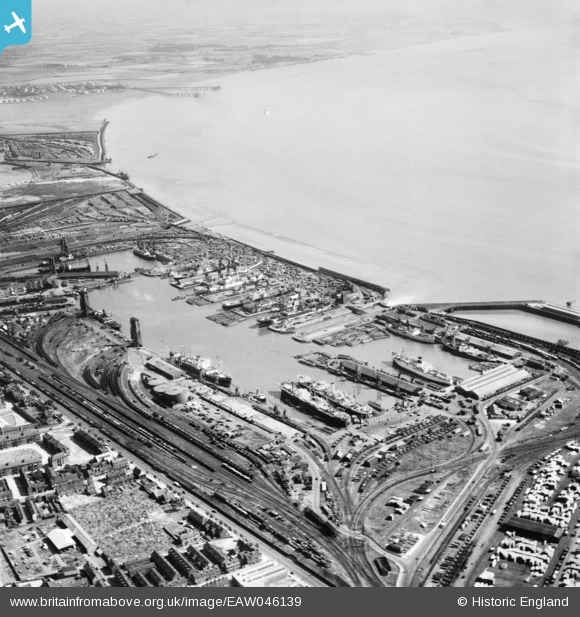
EAW046139 ENGLAND (1952). Alexandra Dock, Kingston upon Hull, from the north-west, 1952
© Copyright OpenStreetMap contributors and licensed by the OpenStreetMap Foundation. 2026. Cartography is licensed as CC BY-SA.
Nearby Images (5)
EAW046139

EAW015661

EAW004505

EPW036555

EPW010818

Details
| Title | [EAW046139] Alexandra Dock, Kingston upon Hull, from the north-west, 1952 |
| Reference | EAW046139 |
| Date | 22-August-1952 |
| Link | |
| Place name | KINGSTON UPON HULL |
| Parish | |
| District | |
| Country | ENGLAND |
| Easting / Northing | 512202, 429076 |
| Longitude / Latitude | -0.29839846556411, 53.745745115133 |
| National Grid Reference | TA122291 |
Pins

John Wass |
Wednesday 20th of August 2014 11:29:30 AM |