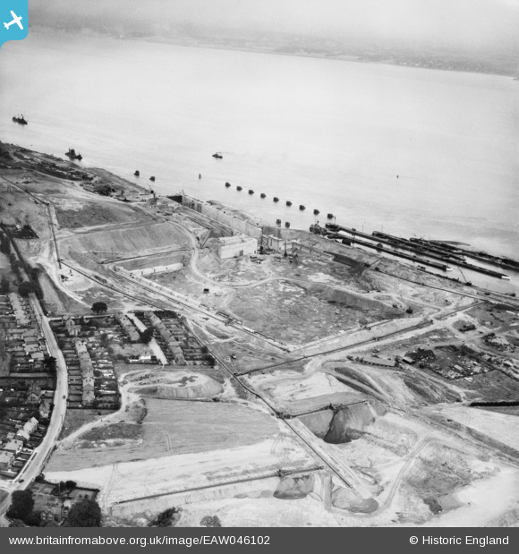
EAW046102 ENGLAND (1952). Construction of the Queen Elizabeth II Dock, Eastham, 1952
© Copyright OpenStreetMap contributors and licensed by the OpenStreetMap Foundation. 2026. Cartography is licensed as CC BY-SA.
Nearby Images (9)
Details
| Title | [EAW046102] Construction of the Queen Elizabeth II Dock, Eastham, 1952 |
| Reference | EAW046102 |
| Date | 25-August-1952 |
| Link | |
| Place name | EASTHAM |
| Parish | |
| District | |
| Country | ENGLAND |
| Easting / Northing | 336800, 381018 |
| Longitude / Latitude | -2.9489109125868, 53.322038085734 |
| National Grid Reference | SJ368810 |
Pins
Be the first to add a comment to this image!


![[EAW046102] Construction of the Queen Elizabeth II Dock, Eastham, 1952](http://britainfromabove.org.uk/sites/all/libraries/aerofilms-images/public/100x100/EAW/046/EAW046102.jpg)
![[EAW046101] Construction of the Queen Elizabeth II Dock, Eastham, 1952](http://britainfromabove.org.uk/sites/all/libraries/aerofilms-images/public/100x100/EAW/046/EAW046101.jpg)
![[EAW046103] Construction of the Queen Elizabeth II Dock, Eastham, 1952](http://britainfromabove.org.uk/sites/all/libraries/aerofilms-images/public/100x100/EAW/046/EAW046103.jpg)
![[EAW046099] Construction of the Queen Elizabeth II Dock, Eastham, 1952](http://britainfromabove.org.uk/sites/all/libraries/aerofilms-images/public/100x100/EAW/046/EAW046099.jpg)
![[EAW046104] Construction of the Queen Elizabeth II Dock, Eastham, 1952](http://britainfromabove.org.uk/sites/all/libraries/aerofilms-images/public/100x100/EAW/046/EAW046104.jpg)
![[EAW015935] Eastham Locks, Eastham, 1948. This image has been produced from a print.](http://britainfromabove.org.uk/sites/all/libraries/aerofilms-images/public/100x100/EAW/015/EAW015935.jpg)
![[EAW015936] Eastham Locks, Eastham, 1948. This image has been produced from a print.](http://britainfromabove.org.uk/sites/all/libraries/aerofilms-images/public/100x100/EAW/015/EAW015936.jpg)
![[EPW027829] Eastham Locks and the Manchester Ship Canal, Eastham, 1929. This image has been produced from a damaged negative.](http://britainfromabove.org.uk/sites/all/libraries/aerofilms-images/public/100x100/EPW/027/EPW027829.jpg)
![[EPW027870] The Eastham Locks and the Manchester Ship Canal, Eastham, 1929](http://britainfromabove.org.uk/sites/all/libraries/aerofilms-images/public/100x100/EPW/027/EPW027870.jpg)