
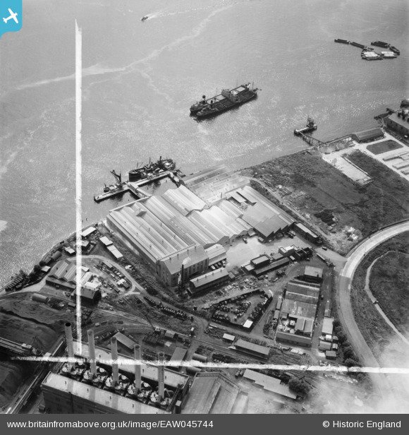
EAW045744 ENGLAND (1952). De Pass Fertilizers Ltd Factory, Creekmouth, 1952. This image was marked by Aerofilms Ltd for photo editing.
© Copyright OpenStreetMap contributors and licensed by the OpenStreetMap Foundation. 2026. Cartography is licensed as CC BY-SA.
Nearby Images (24)
EAW045744

EAW045747

EAW045743

EAW045746

EAW045750

EAW045749

EAW045745

EAW045748

EPW036779

EPW008728

EPW010670

EPW008729

EPW010663

EPW010671

EPW009666

EPW032829

EPW008725

EPW008726

EPW006139

EPW021371

EPW010664

EPW010667

EPW009690

EPW010666

Details
| Title | [EAW045744] De Pass Fertilizers Ltd Factory, Creekmouth, 1952. This image was marked by Aerofilms Ltd for photo editing. |
| Reference | EAW045744 |
| Date | 6-August-1952 |
| Link | |
| Place name | CREEKMOUTH |
| Parish | |
| District | |
| Country | ENGLAND |
| Easting / Northing | 546184, 181617 |
| Longitude / Latitude | 0.10696810328135, 51.514056353838 |
| National Grid Reference | TQ462816 |
Pins
Be the first to add a comment to this image!