
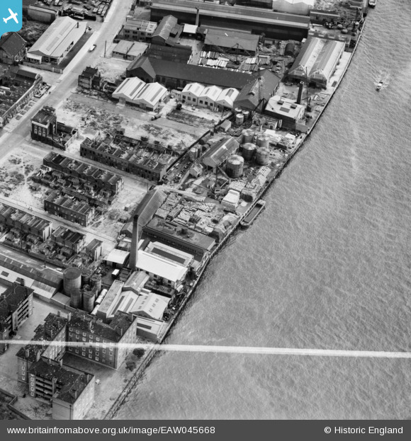
EAW045668 ENGLAND (1952). Winkley's Wharf, Isle of Dogs, 1952. This image was marked by Aerofilms Ltd for photo editing.
© Copyright OpenStreetMap contributors and licensed by the OpenStreetMap Foundation. 2026. Cartography is licensed as CC BY-SA.
Nearby Images (18)
EAW045668

EAW045671

EAW045665

EAW045664

EAW045669

EAW045667

EAW045670

EAW045666

EAW045672

EPW016693

EPW016691

EPW016692

EPW016688

EPW016690

EPW015768

EPW016687

EPW015764

EPW016689

Details
| Title | [EAW045668] Winkley's Wharf, Isle of Dogs, 1952. This image was marked by Aerofilms Ltd for photo editing. |
| Reference | EAW045668 |
| Date | 31-July-1952 |
| Link | |
| Place name | ISLE OF DOGS |
| Parish | |
| District | |
| Country | ENGLAND |
| Easting / Northing | 537112, 178886 |
| Longitude / Latitude | -0.024763154786702, 51.491787453925 |
| National Grid Reference | TQ371789 |
Pins
Be the first to add a comment to this image!