
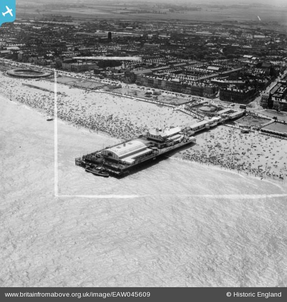
EAW045609 ENGLAND (1952). Britannia Pier and the town, Great Yarmouth, from the north-east, 1952. This image was marked by Aerofilms Ltd for photo editing.
© Copyright OpenStreetMap contributors and licensed by the OpenStreetMap Foundation. 2026. Cartography is licensed as CC BY-SA.
Nearby Images (11)
EAW045609

EAW026623

EAW045607

EAW005071

EPW021186

EAW045614

EAW026624

EAW026625

EAW005072

EPW021196

EAW045612

Details
| Title | [EAW045609] Britannia Pier and the town, Great Yarmouth, from the north-east, 1952. This image was marked by Aerofilms Ltd for photo editing. |
| Reference | EAW045609 |
| Date | 31-July-1952 |
| Link | |
| Place name | GREAT YARMOUTH |
| Parish | |
| District | |
| Country | ENGLAND |
| Easting / Northing | 653414, 307800 |
| Longitude / Latitude | 1.7433647073017, 52.608395247293 |
| National Grid Reference | TG534078 |
Pins

redmist |
Wednesday 19th of January 2022 08:16:44 PM | |

Alan McFaden |
Monday 9th of June 2014 09:09:03 AM |
