
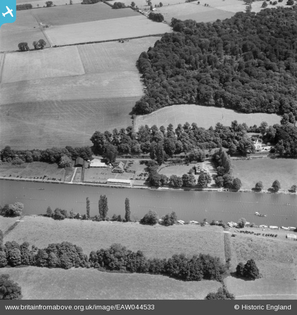
EAW044533 ENGLAND (1952). Remenham, the Henley Royal Regatta course alongside the Remenham Club House and Barn Elms, 1952
© Copyright OpenStreetMap contributors and licensed by the OpenStreetMap Foundation. 2026. Cartography is licensed as CC BY-SA.
Nearby Images (10)
EAW044533

EAW044513

EAW024267
, 1949")
EAW044532

EAW044539

EPW008862

EAW044514

EPW008854

EAW024266

EPW008859

Details
| Title | [EAW044533] Remenham, the Henley Royal Regatta course alongside the Remenham Club House and Barn Elms, 1952 |
| Reference | EAW044533 |
| Date | 4-July-1952 |
| Link | |
| Place name | REMENHAM |
| Parish | REMENHAM |
| District | |
| Country | ENGLAND |
| Easting / Northing | 476757, 183520 |
| Longitude / Latitude | -0.89298527012405, 51.544870457262 |
| National Grid Reference | SU768835 |
Pins
Be the first to add a comment to this image!